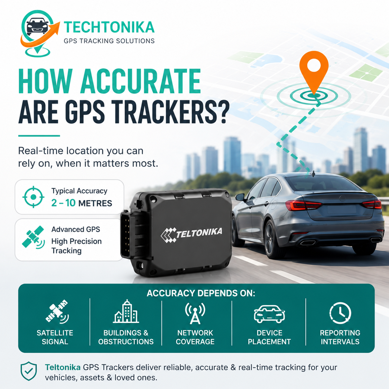
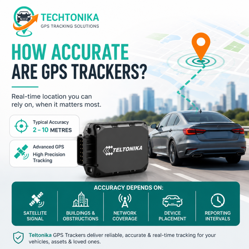
A vehicle GPS tracker often locates within several metres outdoors with a clear sky view, but exactly how accurate are GPS trackers depends on buildings, tunnels, metal, satellite geometry, reflected signals, antenna placement and reporting intervals, which can make the displayed position less precise or temporarily unavailable.
This guide is written for buyers and existing users who want to understand realistic accuracy and apparent tracking errors. It explains the decision in an Australian context, including the completed 3G shutdown, current mobile connectivity, realistic technical limitations, installation quality, privacy and the ongoing service behind the hardware.
The core decision
Start by defining the outcome in one sentence. Examples include receiving an alert when a parked car moves, seeing which technician is closest to a job, reconstructing a route after an incident or locating a trailer that has no permanent power. The sentence should identify the asset, event, acceptable delay and responsible person.
Next, identify constraints: available power, operating environment, mobile coverage, concealment, installation time, required data retention and budget. These constraints eliminate unsuitable device types before minor features are compared.
At-a-glance comparison
| Condition | Expected effect | Practical response |
| Open road, clear sky | Best normal accuracy | Use as baseline |
| CBD high-rise streets | Reflections and drift | Review route context and timestamps |
| Underground parking | No fresh satellite fix | Expect last-known point until exit |
| Under heavy metal | Weak or unavailable signals | Reposition device |
| Sparse reporting | Corners cut on map | Use distance/turn events or shorter interval |
| Delayed upload | Late appearance in app | Check timestamp and network history |
Position accuracy versus tracking accuracy
Position accuracy describes how close a calculated point is to the true location. Tracking quality also includes timestamp, update frequency, continuity and correct event logic.
For buyers and existing users who want to understand realistic accuracy and apparent tracking errors, this is important because the specification on a product page only becomes useful when it is connected to a real operating condition. Consider the normal day, the worst credible event and the person expected to respond. That approach turns a feature into a requirement that can be tested.
A precise point delivered five minutes late may be unsuitable for dispatch. A slightly less precise but timely route may be operationally better.
The practical test is repeatability. Confirm the behaviour in the final vehicle or asset, using the intended network and platform settings. A short controlled trial often exposes power, placement, coverage or notification problems that are invisible during a desk review.
Evaluate the complete record rather than one attractive specification.
Document the chosen setting and the reason for it. This makes future support easier, prevents accidental configuration changes and helps another administrator understand whether the system is operating as designed.
What accuracy is realistic
Open-sky consumer GNSS receivers commonly achieve accuracy within several metres.
For buyers and existing users who want to understand realistic accuracy and apparent tracking errors, this is important because the specification on a product page only becomes useful when it is connected to a real operating condition. Consider the normal day, the worst credible event and the person expected to respond. That approach turns a feature into a requirement that can be tested.
Surveying systems can reach centimetre-level performance using specialised antennas, correction services and processing; that is not the standard for ordinary vehicle trackers.
The practical test is repeatability. Confirm the behaviour in the final vehicle or asset, using the intended network and platform settings. A short controlled trial often exposes power, placement, coverage or notification problems that are invisible during a desk review.
Manufacturers may quote ideal conditions, so field testing is essential.
Document the chosen setting and the reason for it. This makes future support easier, prevents accidental configuration changes and helps another administrator understand whether the system is operating as designed.
Satellite geometry and signal quality
Receivers need signals from multiple satellites distributed across the sky. Poor geometry increases uncertainty.
For buyers and existing users who want to understand realistic accuracy and apparent tracking errors, this is important because the specification on a product page only becomes useful when it is connected to a real operating condition. Consider the normal day, the worst credible event and the person expected to respond. That approach turns a feature into a requirement that can be tested.
Atmospheric effects, obstruction and weak signals affect timing measurements. Multi-constellation receivers can improve availability.
The practical test is repeatability. Confirm the behaviour in the final vehicle or asset, using the intended network and platform settings. A short controlled trial often exposes power, placement, coverage or notification problems that are invisible during a desk review.
The tracker may report quality indicators that help diagnose a questionable point.
Document the chosen setting and the reason for it. This makes future support easier, prevents accidental configuration changes and helps another administrator understand whether the system is operating as designed.
Urban canyons, tunnels and garages
Signals reflect from glass, concrete and buildings, producing multipath errors.
For buyers and existing users who want to understand realistic accuracy and apparent tracking errors, this is important because the specification on a product page only becomes useful when it is connected to a real operating condition. Consider the normal day, the worst credible event and the person expected to respond. That approach turns a feature into a requirement that can be tested.
Tunnels and underground garages block satellites, while dense streets can create drift onto parallel roads.
The practical test is repeatability. Confirm the behaviour in the final vehicle or asset, using the intended network and platform settings. A short controlled trial often exposes power, placement, coverage or notification problems that are invisible during a desk review.
The platform may show the last known point until the receiver obtains a new fix.
Document the chosen setting and the reason for it. This makes future support easier, prevents accidental configuration changes and helps another administrator understand whether the system is operating as designed.
Device placement
Metal shields GNSS and mobile antennas. A tracker buried inside a steel enclosure may perform poorly even if it is expensive.
For buyers and existing users who want to understand realistic accuracy and apparent tracking errors, this is important because the specification on a product page only becomes useful when it is connected to a real operating condition. Consider the normal day, the worst credible event and the person expected to respond. That approach turns a feature into a requirement that can be tested.
Integrated antenna orientation, dashboard structure, tinting materials and nearby electronics can matter.
The practical test is repeatability. Confirm the behaviour in the final vehicle or asset, using the intended network and platform settings. A short controlled trial often exposes power, placement, coverage or notification problems that are invisible during a desk review.
Always validate accuracy after the device is fixed in its final location.
Document the chosen setting and the reason for it. This makes future support easier, prevents accidental configuration changes and helps another administrator understand whether the system is operating as designed.
Reporting and map effects
A tracker does not necessarily send every second. Sparse points connected by straight lines may make a route look inaccurate.
For buyers and existing users who want to understand realistic accuracy and apparent tracking errors, this is important because the specification on a product page only becomes useful when it is connected to a real operating condition. Consider the normal day, the worst credible event and the person expected to respond. That approach turns a feature into a requirement that can be tested.
Map matching can snap a point to a road, while the underlying map or aerial imagery can be slightly misaligned.
The practical test is repeatability. Confirm the behaviour in the final vehicle or asset, using the intended network and platform settings. A short controlled trial often exposes power, placement, coverage or notification problems that are invisible during a desk review.
Network delay affects when a point arrives, not the original GNSS timestamp if data handling is correct.
Document the chosen setting and the reason for it. This makes future support easier, prevents accidental configuration changes and helps another administrator understand whether the system is operating as designed.
Improving results
Use current quality hardware, appropriate placement and sensible moving intervals.
For buyers and existing users who want to understand realistic accuracy and apparent tracking errors, this is important because the specification on a product page only becomes useful when it is connected to a real operating condition. Consider the normal day, the worst credible event and the person expected to respond. That approach turns a feature into a requirement that can be tested.
Enable multiple constellations and assistance features where supported, and keep firmware and configuration managed.
The practical test is repeatability. Confirm the behaviour in the final vehicle or asset, using the intended network and platform settings. A short controlled trial often exposes power, placement, coverage or notification problems that are invisible during a desk review.
Investigate patterns across several trips before replacing hardware based on one anomaly.
Document the chosen setting and the reason for it. This makes future support easier, prevents accidental configuration changes and helps another administrator understand whether the system is operating as designed.
A practical selection process
Step 1: Check the timestamp.
Write down the evidence needed to confirm this step. Use an actual vehicle, asset, user account and notification channel wherever possible. Record the result so installation and support teams work from the same information.
Step 2: Compare multiple consecutive points.
Write down the evidence needed to confirm this step. Use an actual vehicle, asset, user account and notification channel wherever possible. Record the result so installation and support teams work from the same information.
Step 3: Review satellite/GNSS quality if available.
Write down the evidence needed to confirm this step. Use an actual vehicle, asset, user account and notification channel wherever possible. Record the result so installation and support teams work from the same information.
Step 4: Inspect installation and shielding.
Write down the evidence needed to confirm this step. Use an actual vehicle, asset, user account and notification channel wherever possible. Record the result so installation and support teams work from the same information.
Step 5: Separate network delay from location error.
Write down the evidence needed to confirm this step. Use an actual vehicle, asset, user account and notification channel wherever possible. Record the result so installation and support teams work from the same information.
Step 6: Test an open-sky route as a control.
Write down the evidence needed to confirm this step. Use an actual vehicle, asset, user account and notification channel wherever possible. Record the result so installation and support teams work from the same information.
Australian network considerations in 2026
Australia’s 3G network shutdown was completed in 2024. New deployments should use a compatible 4G technology and service. Confirm the exact modem bands, carrier arrangement and coverage rather than relying on a broad 4G description. LTE Cat 1, LTE-M and NB-IoT have different characteristics and are not automatically interchangeable.
ACMA introduced standardised mobile coverage information in 2026, which helps buyers compare published coverage categories. Coverage maps remain predictive: terrain, buildings, antennas, network load and installation affect real performance. For regional operation, test representative routes and verify offline record storage and later upload.
Platform, data and support checklist
- Live map and mobile access are clear for everyday users.
- Trip history includes reliable timestamps and useful playback.
- Alerts can be configured by vehicle, time and recipient.
- User roles restrict access to appropriate vehicles and functions.
- Data retention and export meet operational needs.
- The provider supports the device, SIM, platform and installation pathway.
- Passwords, user removal and access reviews are part of normal administration.
Common mistakes
- Expecting centimetre precision from a vehicle tracker.
- Calling an old point inaccurate without reading its timestamp.
- Comparing a road map and aerial photo as if both are perfectly aligned.
- Ignoring sparse update settings.
- Replacing hardware before checking placement.
Most mistakes are prevented by a short trial, written acceptance criteria and a commissioning checklist. Avoid changing several settings at once during troubleshooting; isolate power, GNSS, mobile connectivity, device logic and platform behaviour in that order.
Costs and value
Compare total cost over the expected ownership period. Include hardware, SIM and mobile data, platform subscription, installation, accessories, support, warranty, replacement and internal administration. An inexpensive unit can become costly if it loses data, requires frequent charging or has no accountable support path.
Value should be tied to the objective. For security, measure alert speed and response readiness. For fleets, measure avoided kilometres, dispatch time, utilisation, verified attendance, maintenance administration or reduced unauthorised use. Do not collect data simply because the device can produce it.
Privacy, workplace use and responsible tracking
Tracking must have a legitimate purpose and lawful authority. Australian surveillance, privacy and workplace requirements vary by jurisdiction and circumstance. The OAIC advises employers to comply with relevant Commonwealth, state and territory laws. NSW’s Workplace Surveillance Act expressly addresses tracking surveillance and contains notice and other requirements.
Businesses should explain what is collected, when tracking occurs, why it is needed, who can access it and how long it is retained. Use permissions, audit access and remove former users promptly. Obtain legal advice for the actual operation, especially for covert surveillance, employee disputes or tracking involving another person. This article is general information, not legal advice.
Why choose Australia Fleet Tracking
Australia Fleet Tracking supplies GPS tracking and telematics solutions for cars, commercial fleets, trucks and assets. The range includes hardwired, OBD, battery-powered and advanced Teltonika devices, supported by tracking software and professional installation options.
For advice, visit https://australiafleettracking.com/, call 0452 653 745 or email Pankaj@techtonika-autolink.com. A short requirements discussion can identify the suitable device, connectivity, installation and platform settings before purchase.
Frequently asked questions
Are trackers accurate to one metre?
Sometimes under excellent conditions, but ordinary vehicle tracking should not depend on constant one-metre accuracy.
Confirm the final answer against the selected device, service plan, vehicle and operating location, because configuration and compatibility can change the practical result.
Why does my car appear in a nearby building?
Signal reflection, map alignment or a weak fix can shift the displayed point.
Confirm the final answer against the selected device, service plan, vehicle and operating location, because configuration and compatibility can change the practical result.
Does 4G improve GPS accuracy?
4G improves communications capability, not the fundamental GNSS measurement.
Confirm the final answer against the selected device, service plan, vehicle and operating location, because configuration and compatibility can change the practical result.
Does weather affect GPS?
Ordinary weather usually has limited effect compared with buildings and metal, though atmospheric conditions contribute to error.
Confirm the final answer against the selected device, service plan, vehicle and operating location, because configuration and compatibility can change the practical result.
Why does the route cut corners?
The reporting interval may be too sparse or the platform may simplify the route.
Confirm the final answer against the selected device, service plan, vehicle and operating location, because configuration and compatibility can change the practical result.
Is phone GPS more accurate?
Phones can use Wi-Fi, mobile and motion assistance. Performance varies; a properly placed tracker can be more consistent for vehicles.
Confirm the final answer against the selected device, service plan, vehicle and operating location, because configuration and compatibility can change the practical result.
Can two trackers show different points?
Yes, due to antenna placement, receiver design, timing and platform processing.
Confirm the final answer against the selected device, service plan, vehicle and operating location, because configuration and compatibility can change the practical result.
How can I test accuracy?
Use a known open location, confirm timestamps and compare several stationary and moving records.
Confirm the final answer against the selected device, service plan, vehicle and operating location, because configuration and compatibility can change the practical result.
What is multipath?
It is error caused when satellite signals reflect from surfaces before reaching the receiver.
Confirm the final answer against the selected device, service plan, vehicle and operating location, because configuration and compatibility can change the practical result.
Does a stronger mobile signal mean better location?
No. Mobile signal affects data delivery; GNSS signal quality affects satellite location.
Confirm the final answer against the selected device, service plan, vehicle and operating location, because configuration and compatibility can change the practical result.
Final takeaway
A vehicle GPS tracker often locates within several metres outdoors with a clear sky view, but accuracy is not constant. Buildings, tunnels, metal, satellite geometry, reflected signals, antenna placement and reporting intervals can make the displayed position less precise or temporarily unavailable.
Choose using evidence: current Australian network compatibility, appropriate power, safe placement, useful software, tested alerts and support that covers the complete system. Then commission it in the real asset and document the configuration.
Sources and editorial references
- Australian Communications and Media Authority, 3G network switch off: https://www.acma.gov.au/3g-network-switch
- Australian Communications and Media Authority, mobile coverage transparency rules (2026): https://www.acma.gov.au/articles/2026-06/new-telco-transparency-rules-now-force
- Geoscience Australia, Positioning and navigation: https://www.ga.gov.au/scientific-topics/positioning-navigation
- Office of the Australian Information Commissioner, Workplace monitoring and surveillance: https://www.oaic.gov.au/privacy/your-privacy-rights/surveillance-and-monitoring/workplace-monitoring-and-surveillance
- NSW Legislation, Workplace Surveillance Act 2005: https://legislation.nsw.gov.au/view/html/inforce/current/act-2005-047/lh
- Australia Fleet Tracking: https://australiafleettracking.com/
Techtonika Autolink
Follow Us
Facebook: https://www.facebook.com/profile.php?id=61591321884124
Instagram: https://www.instagram.com/techtonikaautolink/
LinkedIn: https://au.linkedin.com/company/techtonika-autolink
Unit 507, 15 Chatham Rd West, Ryde NSW 2114